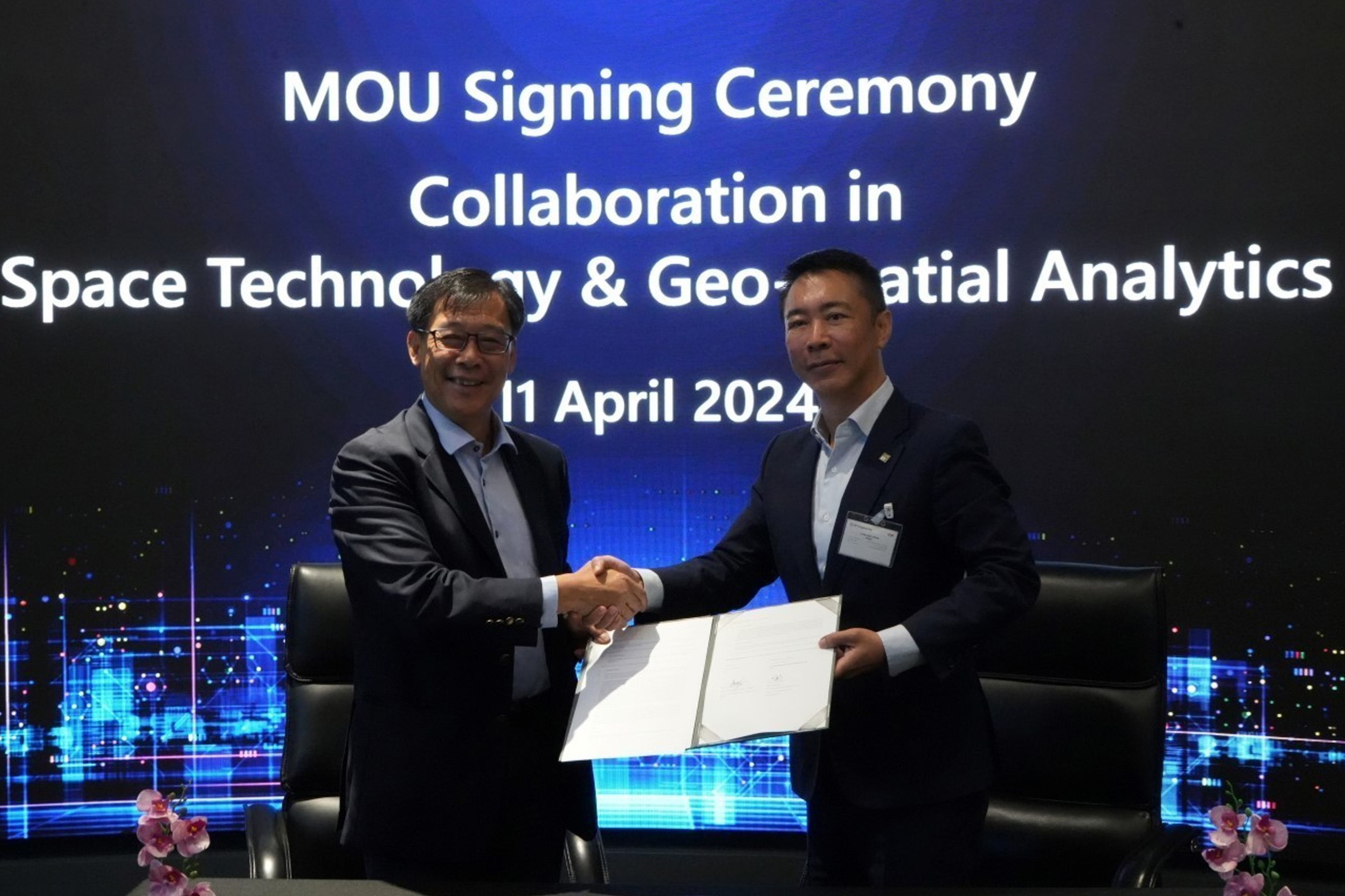
ST Engineering’s Earth observation and geospatial analysis business, ST Engineering Geo-Insights Pte. Ltd. (ST Engineering Geo-Insights), and EY Corporate Advisors Pte. Ltd. (EY) announced the signing of a memorandum of understanding (MOU) in Space Technology and geospatial analytics, aimed at tackling pressing environmental challenges.
Under the MOU, both parties will explore using geospatial data to co-develop sustainability roadmaps and form a joint sustainability product development working group to focus on five key areas, namely deforestation; water management and quality; compliance with Taskforce on Nature-related Financial Disclosures or Task Force on Climate-Related Financial Disclosures requirements; carbon accounting; as well as baselining environmental impacts.
Additionally, both parties will explore co-developing a geospatial platform, integrating ST Engineering Geo-Insights’ capabilities into EY’s existing infrastructure resilience services that focus on rail, roads, water utilities, pipelines and powerlines.
Mr. Goh Ing Nam, General Manager of ST Engineering Geo-Insights, said: “In today's interconnected world, geospatial analysis plays an increasingly vital role across various sectors and industries, spanning urban planning, disaster response to environmental conservation. Our strong expertise in harnessing Earth observation data and conducting geospatial analysis enables us to provide valuable insights and solutions to drive positive change and foster a more sustainable future for generations to come. Our relationship with EY represents an alignment of strengths and resources, dedicated to making meaningful contributions towards a healthier planet.”
Mr. Liew Nam Soon, EY Asean Regional Managing Partner, also Singapore Country Managing Partner at Ernst & Young Solutions LLP, said: “We are excited to work with ST Engineering Geo-Insights and combine its technological capabilities with our deep business and domain knowledge across a wide breadth of industries, giving a unique view of the problems that governments and businesses face in the region. We are convinced that Space Tech can be a gamechanger for a better working world. With Space Tech and analytics, we can derive newfound insights to better understand our natural habitat, the built environment, patterns of human behavior or optimisation opportunities for critical infrastructure, and make smarter decisions to mitigate risks or unlock new opportunities and value for governments, businesses and the broader society.”
This initiative is underpinned by investments in innovation by both parties. EY has developed its own EY Space Tech Lab, which combines satellite imagery and artificial intelligence (AI) to help deliver Earth observation analysis and services to clients through the EY Space for Earth Platform, which is developed by a multi-disciplinary team of data scientists, technologists, and geospatial and product management professionals.
ST Engineering Geo-Insights offers analytics, information products and value-added services based on satellite imagery to address growing global demand for timely insights. It also possesses the capability to provide geospatial solutions that integrate optical and synthetic aperture radar (SAR) data, enabling a holistic view of the Earth's surface. By combining optical imagery for high-resolution visual data with SAR data for all-weather and day-and-night imaging capabilities, ST Engineering Geo-Insights can deliver exceptional insights into diverse applications such as urban planning, disaster monitoring, maritime safety and security, environmental monitoring, as well as agricultural growth tracking.
Significant potential in applications of Space Tech
Space Tech refers to the use of satellites, AI, and human intelligence to design, develop, produce, and use equipment and systems for creating technologies that are required to explore beyond low Earth orbit. It combines the use of a wide range of supporting technologies and infrastructure including spacecraft, satellites, space stations and orbital launch vehicles.
Space Technologies collaborates with 5G, enhanced satellite systems, 3D printing, big data, and quantum computing to improve and grow activities in space that could provide greater visibility over vast distances, time series data, and improved efficiency across various areas of applications.
Some areas that Space Tech applications can have direct impact on include:
- Sustainability (tackling climate change, tracking weather patterns, monitoring water quality and land erosion)
- Environment (monitoring wildlife crime, tracking animals, protecting the environment, monitoring life below water and deforestation)
- Social (responding to natural disasters, managing and preventing pandemics, tracking and predicting poverty, managing crimes, enabling space spinoffs)
- Agriculture (improving crop yield and enabling precision agriculture)
- Infrastructure and public transportation (supporting town maintenance support, monitoring structural health, enabling advanced communication systems and understanding traffic flow patterns)
Find out more here: https://www.ey.com/en_au/space-tech


